Category Archives: Malahide/Mullach Íde

Submission in relation to bathing waters identification in Broadmeadow Estuary

I made the following submission to the Public Participation in the Identification of Bathing Waters for 2017
Submission: Broadmeadow Estuary
Date Submitted: 27.01.2017 – 1:27pm

Unique Reference Number: CVQ-5169
Observations
Title: Broadmeadow Estuary is widely used for dinghy / small boat sailing, windsurfing and kayaking.

These are all sports which involve frequent contact with the water and therefore require water of bathing water quality.

Organised activities are based in Malahide Yacht Club http://www.myc.ie/, Swords Sailing and Boating Club http://swordssailing.ie/ and Fingal Sailing School http://fingalsailingschool.ie/.

All of these rely on the inner estuary. If figures on the numbers involved in these water activities are required for the assessment, please contact them directly to get the necessary information.
These uses are promoted on the Council-supported https://www.malahide.ie/visit.


Malahide Demesne proposal dropped by Council Executive

Following approval by the full Council on 11th July of the combined car park/ multi use area and forest adventure proposal,  a legal challenge was taken by local resident Noel Mahon, one of the Save Malahide Castle Woodland group. Central to the grounds of the challenge were the issues identified by the Council’s Law Agent in her advice of 31st May – that the information put on public display did not comply with the requirements in the legislation.

The Council Executive have now announced that they do not wish to defend the case and are abandoning the proposal.

It is unfortunate that local residents have to resort to legal challenges to achieve adequate information and meaningful public consultation. I hope that the Council Executive and the majority of Councillors who voted for the project will take a lesson from this project.

There is a good practice guide for public participation which we could learn from.. I will work to have the Council implement the Maastricht Recommendations on Promoting Effective Public Participation in Decision-making in Environmental Matters.

The Council Executive’s press release includes:

“It will now, therefore, be necessary to carry out a review of the number of short-term car parking spaces in and adjacent to Malahide Village and, if necessary, identify suitable locations for the provision of additional spaces.”

This of course is what should have been done before any proposal for increased car parking was made. I welcome the study; however I don’t believe it can justify converting any more of Malahide Demesne into carparking. We need to focus on protecting the Demesne and improving access by foot, bicycle and public transport.

Reports on County Development Plan – Cycling motions

Last month’s County Development Plan meetings discussed a wide range of issues. I’m posting some reports in particular on the motions I submitted. I also supported important motions by my Green colleague Roderic O’Gorman and a range of Councillors from all parties.

The largest batch of motions were those on cycling so I’ll address those first.

One of the results of the public display of the draft plan was the receipt of a range of submissions criticising the inadequacy of the policies contained in the draft as regards cycling.These came from a range of parties, including the National Transport Authority which suggested that the policies in relation to cycling in the plan could be strengthened.

In response to these submissions, I submitted a range of proposed amendments, many of which were directly extracted from the National Cycle Policy Framework (NCPF), particularly the policies and actions identified in the Framework for implementation by local authorities.

In advising the Councillors on the motions submitted, the Council management first claimed that many of the motions submitted were invalid as they didn’t relate to submissions received. This label was applied to 15 of the 21 amendments which I proposed based on the NCPF. When I pointed out their origin this claim did not resurface.

When it came to the discussions, the first two cycling related motions were

  • to mark the cycle routes from the Greater Dublin Area Cycle Network Plan on the Development Plan maps the same as the other cycle routes already proposed
  • to provide safe routes to school as part of the process of identifying and procuring new school sites

It was a bit of a surprise that, unfortunately, the Planning Department opposed both of these. The majority of Councillors supported my motion to mark the GDA routes on the maps despite the official advice against it.

However they also opposed my proposal that safe walking and cycling routes would be provided to new schools  as part of the school development process and a slim majority of Councillors voted it down. The media, starting with the cycling journalism website Irishcycle.com, naturally took an interest in this and reported it the following week: Irishcycle.com, TheJournal.ie, DublinLive.ie.

At the following meeting, the officials continued to oppose the cycling motions and a number of other important motions were defeated including a proposal to implement HGV management strategies in urban areas, a proposal to carry out remedial measures to existing cyclist unfriendly urban roads and a proposal to provide safe cycling and walking routes to existing schools during the lifetime of the plan including an audit of all schools. These motions were all based on the National Cycle Policy Framework adopted in 2009, but despite that the officials convinced a majority of Councillors to vote them down.

At a subsequent meeting, the media attention to the vote against safe routes to schools started to have an impact and my motions to provide cycle routes from Holywell, Portmarnock and Balgriffin to Kinsealy to serve the proposed new secondary school there and the existing primary schools were all successful. So overall, a mixture of good and bad news.


screen-shot-2016-09-06-at-18-00-52

Proposed greenway style cycle route from Kettle’s Lane to Kinsealy via Abbeville

28690_20160904210055

Proposed greenway style cycle route from Portmarnock to Kinsealy

28694_20160904210613

Proposed greenway style cycle route from Balgriffin to Kinsealy

The amendments to the Draft Plan are on public display until 2nd December. At this stage they are only proposed amendments; they could be overturned following the consultation. So if you agree with any of the amendments, make sure to make a submission!

I’m still following up on the National Cycle Policy Framework (NCPF) issue. The media reports on the motion for safe routes to schools which was defeated, led to me learning from a member of the public of the existence of Planning Circular_pssp_8_2010_on NCPF_and_development_plans. This circular requires the Council to make the Development Plan consistent with the NCPF.

All of the cycling related motions had already been dealt with when I received the Circular but I immediately drew the attention of the next Council meeting dealing with the Development Plan to the obligations placed on the Council by the Circular. The Council officials were unwilling to recognise that the Circular had any significance to the process or to revisit the issues.

I have written to the Minister for Housing and Planning in relation to this.

Proposals in Malahide Demesne for a Forest Adventure Area and an Extension to the Bridgefield Car Park

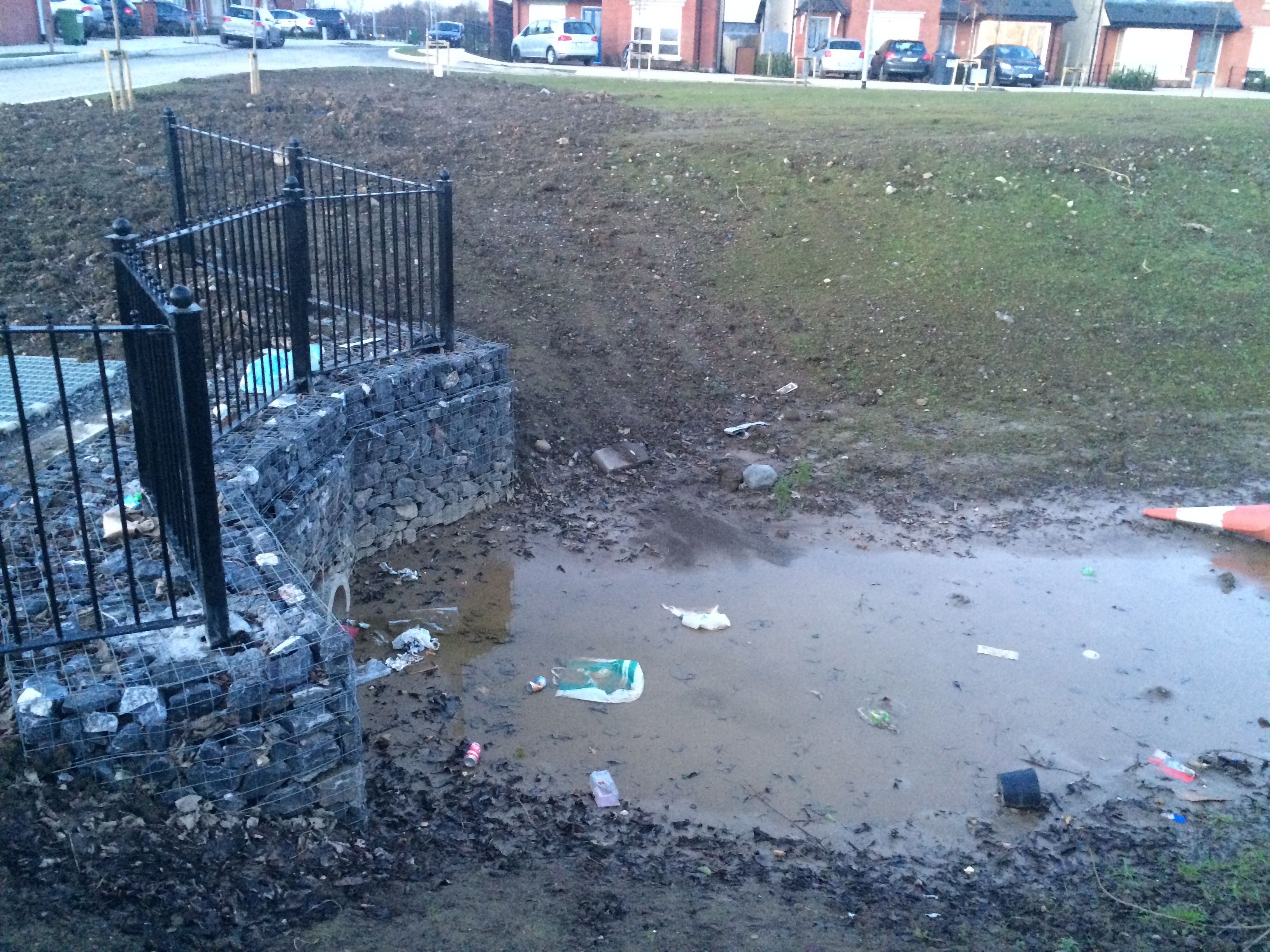
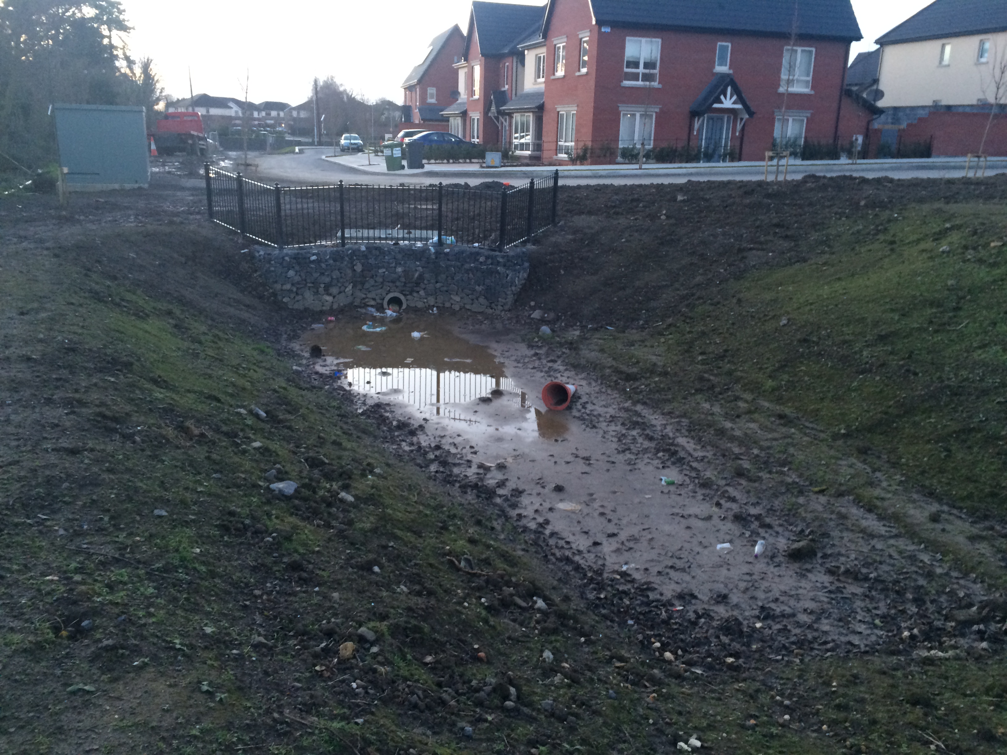
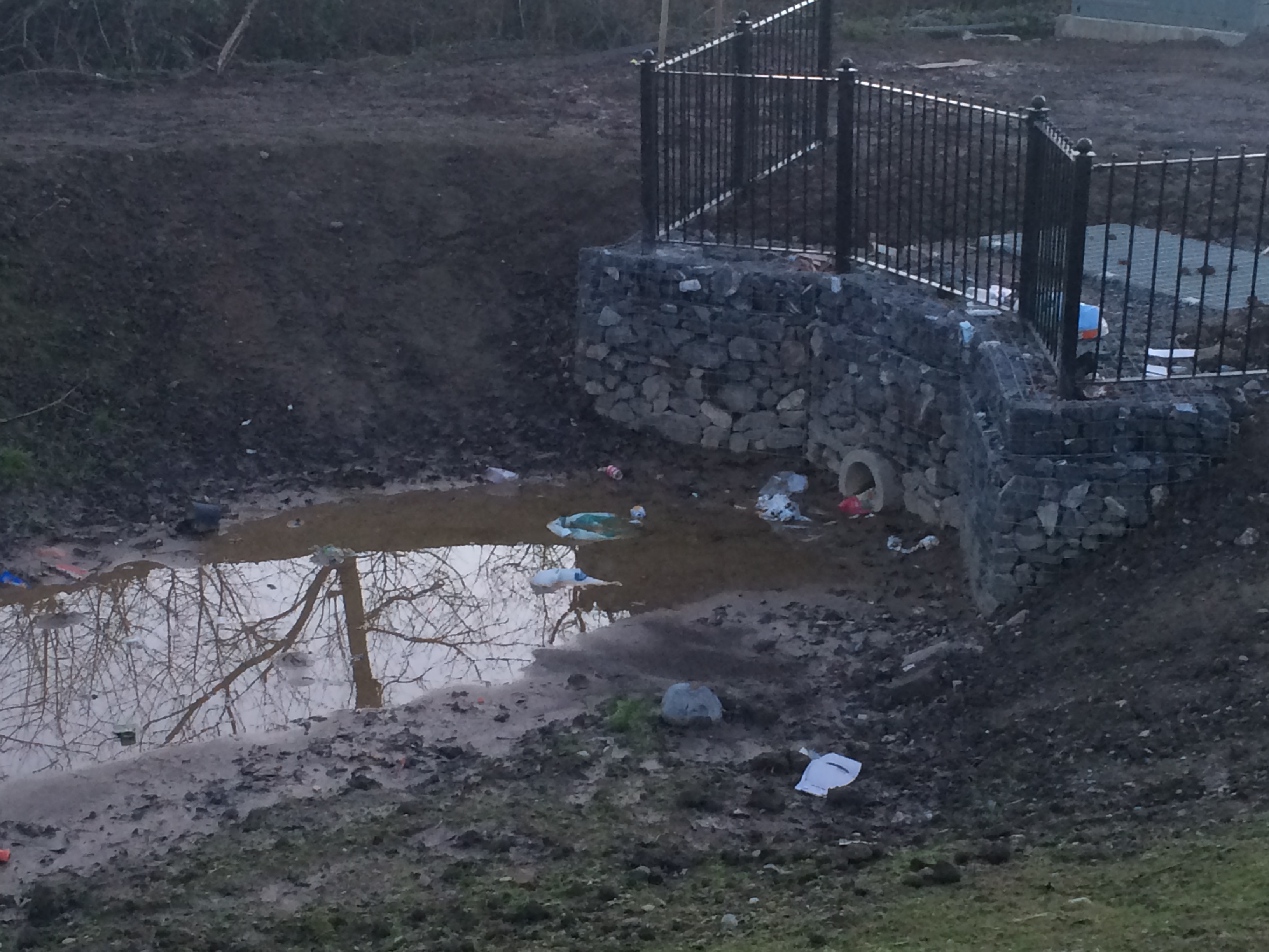
Late last year a proposal was brought before the Councillors for a “Forest Adventure Area and Multi-use Reinforced Grass Area.”

In principle I think a canopy walk or similar somewhere in Malahide Demesne could be an excellent proposal. However it would depend on the design and details of the proposal including its environmental impact and its impact on park users.

That information is not available because it doesn’t yet exist.

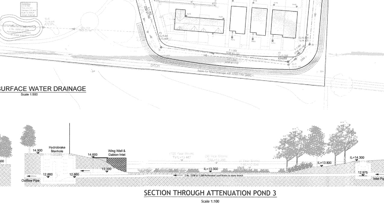
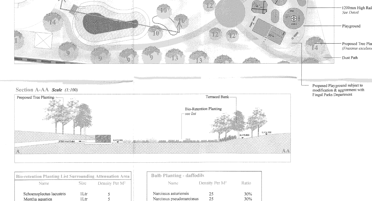
I pointed out the inadequacies in the information supplied at the December Area Committee meeting, saying I expected that detailed information would be in the proposal put on public display. I didn’t receive a reply to that comment at the meeting and unfortunately it didn’t happen. I also pointed out that they proposal appeared to be two separate and distinct proposals and suggested they be put to consultation separately. The joint proposal was nonethless put on display as presented to the Councillors:

So I checked the applicable legislation to establish what is legally required to be put on display.   The regulations provide as follows:

83.(1) A local authority shall make available for inspection in accordance with article 81(2)(d)(i)—

(a) a document describing the nature and extent of the proposed development and the principal features thereof, including-

(i) where the proposed development would consist of or comprise the provision of houses, the number of houses to be provided,

(ii) where proposed development would relate to a protected structure or a proposed protected structure, an indication of that fact,

(iii) where the proposed development would comprise or be for the purposes of an activity requiring an integrated pollution control licence or a waste licence, an indication of that fact,

(b) a location map, drawn to a scale of not less than 1:1000 in built up areas and 1:2500 in all other areas (which shall be identified thereon) and marked or coloured so as to identify clearly the land on which it is proposed to carry out the proposed development,

(c) except in the case of development of a class specified in article 80(1)(b) or (c),—

(i) a site layout plan, drawn to a scale of not less than 1:500, showing the boundary of the site on which it is proposed to carry out the proposed development and the buildings or other structures, and roads or other features, in the vicinity of the site, and

(ii) such other plans and drawings, drawn to a scale of not less than 1:100, as are necessary to describe the proposed development,

(d) in the case of development of a class specified in article 80(1)(b), such plans and drawings drawn to a scale of not less than 1:2500, as are necessary to describe the proposed development,

(e) in the case of development of a class specified in article 80(1) (c), such plans and drawings drawn to a scale of not less than 1:200, as are necessary to describe the proposed development.

The requirements which I have highlighted in bold have not been met.

At the May Area Committee meeting I asked the officials to confirm that the above is the applicable legislation, which they did. The Committee then agreed to my proposal to ask the Law Agent for advice, to be received before the June meeting. As of today (Monday 30th May) that advice has not yet been received by the Councillors.

The Parks Department have confirmed that they are trying to get an approval before the design is done.

It is clear to me that it would not be legal for the Councillors to give Part 8 approval to a project which hasn’t been designed and for which the information required to be put on public display has not been made available. I will be most surprised if the Law Agent advises otherwise.

It may be less convenient, but the correct procedure, as for any one else making another type of planning application, is to produce a design, put that design on display and make a decision on the basis of the design and the public consultation.

As for the Car Park extension, this was originally presented to Councillors as a multi-use area. It later became clear from the Planning Department that they see it as a car park extension. Such a proposal should only be considered, if at all, in the context of overall changes to traffic and parking in the town – which to date have not been proposed.

UPDATE 31st May:

This afternoon the Councillors received the Law Agent’s advice which sets out the legal requirements which have not been met and warns that going ahead with the project would be vulnerable to legal challenge. I expect that the current process will be abandoned.

I hope the Parks Department will continue to work on the idea of a forest adventure area with a view to coming up with a clear proposal which everyone would welcome.

UPDATE 1st July:

The Councillors at the June Howth/Malahide Area Committee voted 5 to 3 against approving the project, all of the majority asking for the two proposals to be separated from each other and for proper design and analysis to be done on the forest adventure area, which we all would like to see in principle.

The Parks Department have indicated that notwithstanding the vote at the Area Committee, they will be asking the full Council meeting on 11th July to approve the project.

“Sustainable Urban Drainage” in Malahide becomes dysfunctional hole dug in open space

IMG_3961The new development Coill Dubh (opposite Malahide Community School) is supposed to have a sustainable urban drainage system in order to prevent runoff from the development causing flooding in the area. The drawings are shown in the planning file (F12A/0242) which was granted by An Bord Pleanála (overruling their inspector who recommended refusal on pedestrian safety grounds.)

It seems that what has been built is in breach of the drawings. Additionally, the landscaping and drainage was required by condition to be finished before the houses were occupied and that certainly isn’t the case.

Below are relevant extracts from the planning application and the conditions imposed by An Bord Pleanála, followed by photographs of what the ‘open space looks like at the moment.Screen Shot 2016-02-27 at 7.31.19 PM Screen Shot 2016-02-27 at 7.31.01 PMScreen Shot 2016-02-27 at 7.35.26 PM  Screen Shot 2016-02-27 at 7.29.54 PM  Screen Shot 2016-02-27 at 7.28.33 PM

IMG_3960 IMG_3954 IMG_3953 IMG_3951 IMG_3950 IMG_3962What has been built is spectacularly different to the original drawings. It is public health and safety hazard and it is a disgrace that it has been put in the middle of a public open space. The Council’s Planning Department must address this immediately.